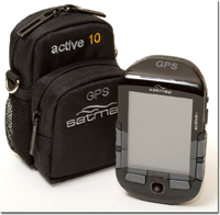
So, it's a bit late, but I thought I'd better finish off the review.
Positives first:
- Ease of plotting a route. For mountain bikers a big selling point is the ability to go out & explore, then plot a route back home from wherever you happen to be. This is great for MTBers as you can cover more ground on a bike & exploring will get you 'lost' more quickly than on foot.
- Many people like to use a GPS to log their progress which the Satmap seems to do accurately. If you want a GPS for this purpose you might find the other features unnecessary, but you might become convinced by the value of the map display
- A major plus for bikers is the replaceable screen cover. There's a fair bit of peace of mind knowing that if it gets scratched a replacement is cheap & available. I only used the unit in the dry, but someone who owns a unit told me that in the wet, moisture gets behind the cover making the display harder to read, so maybe some better sealing might be needed?
- The unit has a tough feel to it which is big plus for MTBers.
- The main negative I found is the battery level display. It shows as maximum for ages, but when the batteries run out there's very little warning. Another owner I met mentioned the same problem. The batteries supplied gave about 2 days worth, but they were the expensive Lithium type, so to use these regularly would be quite expensive. I guess this wouldn't concern everyone. A rechargeable is available and comes as standard if you buy the MTB kit. If however the unit's being used for expedition type journeys then there might not be chance to recharge. It may well be good in comparison to other units, but more battery life is always a good improvement.
- As far as I know the screen on the unit is good in comparison to others, but I found the display very difficult to read in sunlight. I'm guessing this is the case with most GPS units, but one of Satmap's selling points was that it was easy to read in sunlight. It's a bit of a pain needing to find shade in order to see the display, and sometimes that means that a map in a map holder is faster to use.
- Sometimes the map didn't orientate correctly which meant if I was relying on the unit it caused wrong turns. This happened mainly on just one route, others were OK. The three of us on the ride thought that using the unit had lengthened the journey time a fair bit over using an OS map.
- I didn't find the menu system that intuitive. I got used to it, but I'm quite good with gadgets and often don't need instruction manuals, but I had to keep referring back to the manual for a lot longer than usual.
- Most MTBers will ride with gloves all year round, and usually full fingered ones. The buttons are a bit awkward to use with gloves. I thought they lacked feel without gloves & even thin gloves made it worse. A light-ish touch combined with a more definite click to the buttons would be ideal I think. This isn't a major gripe though.
- Another minor was the bulk of the unit. It would be nice if any future versions were smaller or thinner. Crashes are inevitable at some point when mountain biking, and it's not always possible to mount the unit in a way that would avoid damage in a fall. For some bikes maybe putting it on the top tube would work, but if the frame tubes are fatter the unit ends up being too far back & the rider's knees would hit it.
If you're after a GPS with OS Maps I'd say this is a good one to go for, some of the other similar models from other brands have some major disadvantages like no option to change batteries so if the rechargeable one runs out you're stuck, or just generally dissatisfied owner reviews on the net.


Yea the disorientation of the map was a right bugger on that ride! I mentioned it to Phil at the shop and he could only assume it was a fault. Still not sure about that one.
ReplyDeleteI agree when you say the Satmap has a durable feel to it and in some ways buttons as opposed to touch screen are more appropriate for a MTBer.
Other options for on-screen OS mapping include the Memory Map Adventurer 2800 and the Garmin Oregon. These are both touch screen, which probably has it's benefits and drawbacks in about equal measure.
As Steve mentioned, the Memory Map has a built in Lithium Ion battery, which will last OK, but is not replaceable, so is not ideal for multi-dayers. The Oregon and the Satmap both use AA batteries and so can be replaced on the trail if necessary (just don't forget the spares!).